
Hjerkinn topographic map
Interactive map
Click on the map to display elevation.
About this map
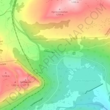
Name: Hjerkinn topographic map, elevation, terrain.
Location: Hjerkinn, Dovre, Innlandet, 2661, Norway (62.20155 9.54251 62.24155 9.58251)
Average elevation: 3,386 ft
Minimum elevation: 2,825 ft
Maximum elevation: 4,199 ft