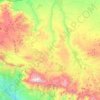
Ventas de Zafarraya topographic map
Click on the map to display elevation.
Ventas de Zafarraya
Ventas de Zafarraya is in the municipality of Alhama de Granada, Granada, Spain. It has an area of 19.23 square kilometres (7.42 sq mi) and is at an elevation of 920 metres (3,020 ft). As of 2019 the population was 1,181. The postal code is 18125. The village is on the road from Alhama de Granada in the west of Granada to Vélez-Málaga in the Axarquía of Malaga. Due to its location on this important route the population grew quickly in the second half of the 20th century.
About this map

Name: Ventas de Zafarraya topographic map, elevation, terrain.
Average elevation: 3,035 ft
Minimum elevation: 2,057 ft
Maximum elevation: 4,377 ft
Other topographic maps
Click on a map to view its topography, its elevation and its terrain.
Parque Natural Sierra de Tejeda, Almijara y Alhama
Spain > Andalusia > Comarca de Alhama
Average elevation: 2,474 ft