
Thank you for supporting this site ❤️
Make a donation
Make a donation
Gear up for your next adventure:
As an Amazon Associate, this site earns from qualifying purchases at no extra cost to you.
Draria topographic map
Click on the map to display elevation.
Thank you for supporting this site ❤️
Make a donation
Make a donation
Gear up for your next adventure:
As an Amazon Associate, this site earns from qualifying purchases at no extra cost to you.
About this map
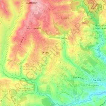
Name: Draria topographic map, elevation, terrain.
Location: Draria, Draria District, Algiers, Algeria (36.69220 2.98045 36.73524 3.02741)
Average elevation: 554 ft
Minimum elevation: 249 ft
Maximum elevation: 820 ft
Thank you for supporting this site ❤️
Make a donation
Make a donation
Gear up for your next adventure:
As an Amazon Associate, this site earns from qualifying purchases at no extra cost to you.
Other topographic maps
Click on a map to view its topography, its elevation and its terrain.
617 apartment district
Algeria > Algiers > Draria District > Draria > Draria > 617 apartment district
Average elevation: 646 ft