
Almagro topographic map
Interactive map
Click on the map to display elevation.
About this map
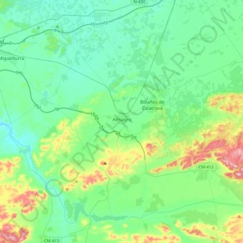
Name: Almagro topographic map, elevation, terrain.
Average elevation: 2,185 ft
Minimum elevation: 1,952 ft
Maximum elevation: 3,022 ft
Other topographic maps
Click on a map to view its topography, its elevation and its terrain.
Monte Cayo
España > Castilla-La Mancha > Campo de Calatrava > Almagro
Monte Cayo, Almagro, Campo de Calatrava, Ciudad Real, Castilla-La Mancha, España
Average elevation: 2,077 ft
Aldea del Rey
España > Castilla-La Mancha > Campo de Calatrava
Aldea del Rey, Campo de Calatrava, Ciudad Real, Castilla-La Mancha, España
Average elevation: 2,421 ft