
Colonial Hills topographic map
Click on the map to display elevation.
About this map
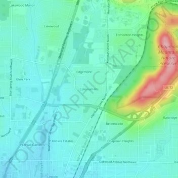
Name: Colonial Hills topographic map, elevation, terrain.
Average elevation: 725 ft
Minimum elevation: 620 ft
Maximum elevation: 1,099 ft
Madison County trails, hiking, mountain biking, running and outdoor activities
Other topographic maps
Click on a map to view its topography, its elevation and its terrain.
Monte Sano State Park
United States > Alabama > Madison County > Huntsville
Average elevation: 1,152 ft