
Thank you for supporting this site ❤️
Make a donation
Make a donation
Gear up for your next adventure:
As an Amazon Associate, this site earns from qualifying purchases at no extra cost to you.
Morgarten topographic map
Click on the map to display elevation.
Thank you for supporting this site ❤️
Make a donation
Make a donation
Gear up for your next adventure:
As an Amazon Associate, this site earns from qualifying purchases at no extra cost to you.
About this map
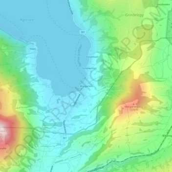
Name: Morgarten topographic map, elevation, terrain.
Location: Morgarten, Oberägeri, Zug, 6315, Switzerland (47.08451 8.62153 47.12451 8.66153)
Average elevation: 2,927 ft
Minimum elevation: 2,346 ft
Maximum elevation: 4,616 ft
Thank you for supporting this site ❤️
Make a donation
Make a donation
Gear up for your next adventure:
As an Amazon Associate, this site earns from qualifying purchases at no extra cost to you.