
Thane Creek topographic map
Interactive map
Click on the map to display elevation.
About this map
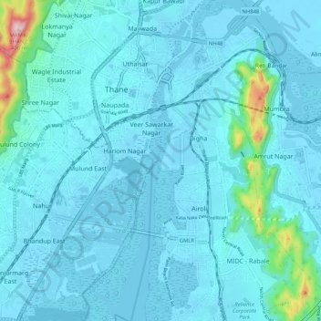
Name: Thane Creek topographic map, elevation, terrain.
Location: Thane Creek, Kharegaon, Thane, Maharashtra, 400605, India (19.12428 72.97344 19.22132 73.00855)
Average elevation: 108 ft
Minimum elevation: -16 ft
Maximum elevation: 1,319 ft