
Tizi topographic map
Interactive map
Click on the map to display elevation.
About this map
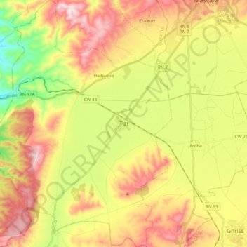
Name: Tizi topographic map, elevation, terrain.
Location: Tizi, Daïra Tizi, Mascara, Algérie (35.23771 -0.03489 35.39399 0.11121)
Average elevation: 1,627 ft
Minimum elevation: 781 ft
Maximum elevation: 2,500 ft