
Shimabara topographic map
Interactive map
Click on the map to display elevation.
About this map
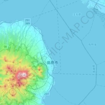
Name: Shimabara topographic map, elevation, terrain.
Location: Shimabara, Préfecture de Nagasaki, Japon (32.69691 130.27281 32.91946 130.48195)
Average elevation: 381 ft
Minimum elevation: -13 ft
Maximum elevation: 4,774 ft