Geolocate

Wayu topographic map

Click on the map to display elevation.

About this map

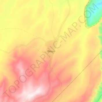
Name: Wayu topographic map, elevation, terrain.

Location: Wayu, Jimma Rare, Horo Guduru, Oromia Region, Ethiopia (9.19056 37.32080 9.27056 37.40080)

Average elevation: 7,602 ft

Minimum elevation: 5,791 ft

Maximum elevation: 8,829 ft

Gear up for your next adventure:

📚Navigation Handbooks - Master the art of reading topographic maps and using a compass
🦶Hiking Gaiters - Keep debris and water out of your boots
🖼️Topo Map Wall Art - Decorative topographic prints of famous peaks and regions
🥩Freeze-Dried Meals - Nutritious and lightweight food for remote expeditions
📦Gear Storage Bags - Organize and protect outdoor equipment

As an Amazon Associate, this site earns from qualifying purchases at no extra cost to you.