
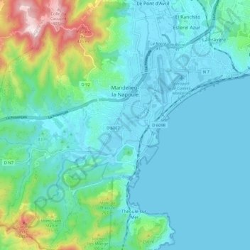
Mandelieu-la-Napoule topographic map
Interactive map
Click on the map to display elevation.
About this map
Name: Mandelieu-la-Napoule topographic map, elevation, terrain.
Average elevation: 299 ft
Minimum elevation: -13 ft
Maximum elevation: 1,693 ft