
关山 topographic map
Interactive map
Click on the map to display elevation.
About this map
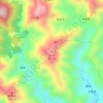
Name: 关山 topographic map, elevation, terrain.
Location: 关山, Huangshan, Anhui, Chine (30.05463 118.39463 30.05473 118.39473)
Average elevation: 1,545 ft
Minimum elevation: 856 ft
Maximum elevation: 2,451 ft
Other topographic maps
Click on a map to view its topography, its elevation and its terrain.
District de Tunxi
District de Tunxi, Huangshan, Anhui, Chine
Average elevation: 545 ft