

Lugo topographic map
Click on the map to display elevation.
Lugo
The town lies on a hill surrounded by the rivers Miño, Rato and Chanca. The difference in altitude between the city centre and the river banks is considerable: the former being at an altitude of 465 meters above sea level, whilst the Miño River Walk is at an altitude of only 364 metres (1,194 feet). The municipality of Lugo is the second largest in Galicia, with 329.78 square kilometres (127.33 sq mi) and 59 parishes. The outline of the city was declared a Biosphere Reserve by UNESCO on 7 November 2002, this being the most important recognition at international level regarding the conservation of landscapes and habitats of this Atlantic European region.
About this map
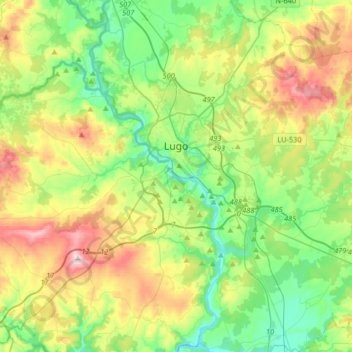
Name: Lugo topographic map, elevation, terrain.
Location: Lugo, Galicia, Spain (42.88330 -7.73527 43.09872 -7.40598)
Average elevation: 1,604 ft
Minimum elevation: 1,119 ft
Maximum elevation: 2,556 ft