
Thank you for supporting this site ❤️
Make a donation
Make a donation
Gear up for your next adventure:
As an Amazon Associate, this site earns from qualifying purchases at no extra cost to you.
Kothur topographic map
Click on the map to display elevation.
Thank you for supporting this site ❤️
Make a donation
Make a donation
Gear up for your next adventure:
As an Amazon Associate, this site earns from qualifying purchases at no extra cost to you.
About this map
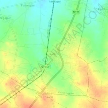
Name: Kothur topographic map, elevation, terrain.
Location: Kothur, Kothur mandal, Rangareddy, Telangana, 509228, India (17.12861 78.26869 17.16861 78.30869)
Average elevation: 1,946 ft
Minimum elevation: 1,877 ft
Maximum elevation: 2,014 ft
Thank you for supporting this site ❤️
Make a donation
Make a donation
Gear up for your next adventure:
As an Amazon Associate, this site earns from qualifying purchases at no extra cost to you.