
Hazārībāg topographic map
Interactive map
Click on the map to display elevation.
About this map
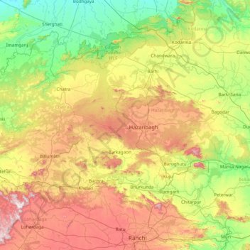
Name: Hazārībāg topographic map, elevation, terrain.
Location: Hazārībāg, Hazaribagh, Jharkhand, India (23.30000 84.55000 24.70000 85.95000)
Average elevation: 1,371 ft
Minimum elevation: 364 ft
Maximum elevation: 3,540 ft