
Fröbershammer topographic map
Interactive map
Click on the map to display elevation.
About this map
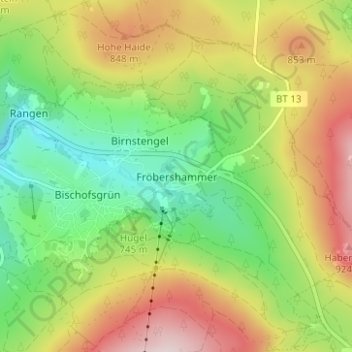
Name: Fröbershammer topographic map, elevation, terrain.
Average elevation: 2,484 ft
Minimum elevation: 1,991 ft
Maximum elevation: 3,130 ft
Other topographic maps
Click on a map to view its topography, its elevation and its terrain.
Sattelbogen
Duitsland > Beieren > Landkreis Bayreuth > Betzenstein
Sattelbogen, Betzenstein, Betzenstein (VGem), Landkreis Bayreuth, Beieren, 91282, Duitsland
Average elevation: 1,778 ft
Pilgerndorf
Duitsland > Beieren > Landkreis Bayreuth > Hollfeld
Pilgerndorf, Hollfeld, Hollfeld (VGem), Landkreis Bayreuth, Beieren, 95515, Duitsland
Average elevation: 1,545 ft