
Thank you for supporting this site ❤️
Make a donation
Make a donation
Gear up for your next adventure:
As an Amazon Associate, this site earns from qualifying purchases at no extra cost to you.
Rheder topographic map
Click on the map to display elevation.
Thank you for supporting this site ❤️
Make a donation
Make a donation
Gear up for your next adventure:
As an Amazon Associate, this site earns from qualifying purchases at no extra cost to you.
About this map
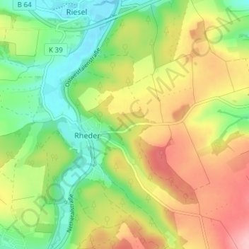
Name: Rheder topographic map, elevation, terrain.
Location: Rheder, Brakel, Kreis Höxter, North Rhine-Westphalia, Germany (51.66284 9.14479 51.70077 9.20416)
Average elevation: 646 ft
Minimum elevation: 430 ft
Maximum elevation: 915 ft
Thank you for supporting this site ❤️
Make a donation
Make a donation
Gear up for your next adventure:
As an Amazon Associate, this site earns from qualifying purchases at no extra cost to you.