
Gámbita topographic map
Interactive map
Click on the map to display elevation.
About this map
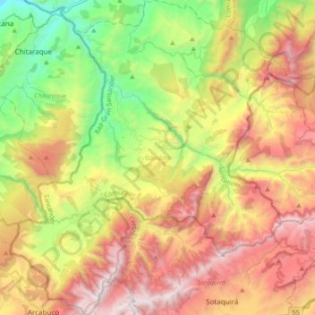
Name: Gámbita topographic map, elevation, terrain.
Location: Gámbita, Comunera, Santander, Colombie (5.75123 -73.47136 6.08146 -73.17625)
Average elevation: 7,867 ft
Minimum elevation: 4,409 ft
Maximum elevation: 12,224 ft