
Oberstdorf topographic map
Interactive map
Click on the map to display elevation.
About this map
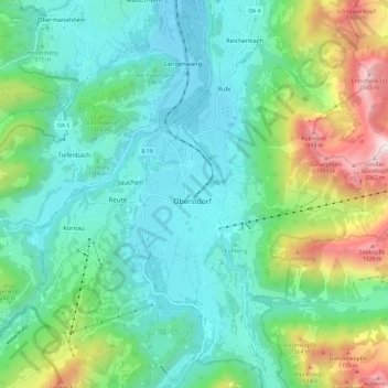
Name: Oberstdorf topographic map, elevation, terrain.
Location: Oberstdorf, Landkreis Oberallgäu, Beieren, 87561, Duitsland (47.37183 10.23810 47.45183 10.31810)
Average elevation: 3,602 ft
Minimum elevation: 2,493 ft
Maximum elevation: 6,886 ft