
Fischen topographic map
Interactive map
Click on the map to display elevation.
About this map
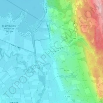
Name: Fischen topographic map, elevation, terrain.
Average elevation: 1,893 ft
Minimum elevation: 1,739 ft
Maximum elevation: 2,418 ft
Other topographic maps
Click on a map to view its topography, its elevation and its terrain.
Bernbeuren
Deutschland > Bayern > Landkreis Weilheim-Schongau
Bernbeuren, Bernbeuren (VGem), Landkreis Weilheim-Schongau, Bayern, 86975, Deutschland
Average elevation: 2,589 ft