
Darmós topographic map
Interactive map
Click on the map to display elevation.
About this map
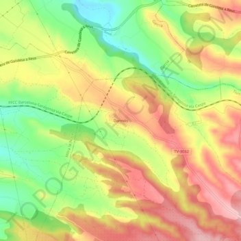
Name: Darmós topographic map, elevation, terrain.
Average elevation: 456 ft
Minimum elevation: 154 ft
Maximum elevation: 722 ft
Other topographic maps
Click on a map to view its topography, its elevation and its terrain.
Punta de l'Àliga
España > Cataluña > Ribera de Ebro > Tivissa
Punta de l'Àliga, Tivissa, Ribera de Ebro, Tarragona, Cataluña, 43320, España
Average elevation: 1,722 ft