Los Torres topographic map
Interactive map
Click on the map to display elevation.
About this map
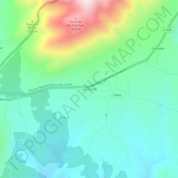
Name: Los Torres topographic map, elevation, terrain.
Average elevation: 3,786 ft
Minimum elevation: 3,117 ft
Maximum elevation: 5,696 ft

Click on the map to display elevation.
Name: Los Torres topographic map, elevation, terrain.
Average elevation: 3,786 ft
Minimum elevation: 3,117 ft
Maximum elevation: 5,696 ft