
Hochzoll topographic map
Interactive map
Click on the map to display elevation.
About this map
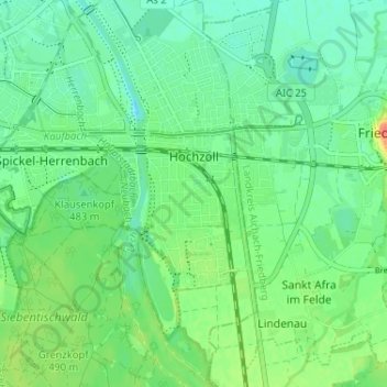
Name: Hochzoll topographic map, elevation, terrain.
Location: Hochzoll, Augsburg, Bayern, 86163, Deutschland (48.32694 10.93144 48.36990 10.95674)
Average elevation: 1,598 ft
Minimum elevation: 1,549 ft
Maximum elevation: 1,696 ft