
Añelo topographic map
Interactive map
Click on the map to display elevation.
About this map
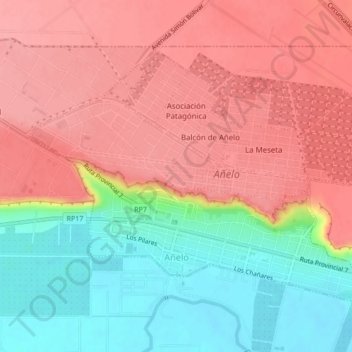
Name: Añelo topographic map, elevation, terrain.
Location: Añelo, Departamento Añelo, NQN, 8312, Argentine (-38.35841 -68.82879 -38.34011 -68.76465)
Average elevation: 1,463 ft
Minimum elevation: 1,280 ft
Maximum elevation: 1,627 ft