
Fahndorf topographic map
Interactive map
Click on the map to display elevation.
About this map
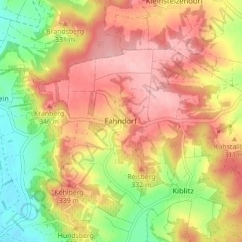
Name: Fahndorf topographic map, elevation, terrain.
Average elevation: 988 ft
Minimum elevation: 725 ft
Maximum elevation: 1,194 ft
Other topographic maps
Click on a map to view its topography, its elevation and its terrain.
Radlbrunn
Österreich > Niederösterreich > Bezirk Hollabrunn > Gemeinde Ziersdorf
Radlbrunn, Gemeinde Ziersdorf, Bezirk Hollabrunn, Niederösterreich, 3710, Österreich
Average elevation: 945 ft