
Flohimont topographic map
Interactive map
Click on the map to display elevation.
About this map
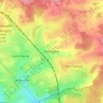
Name: Flohimont topographic map, elevation, terrain.
Average elevation: 1,598 ft
Minimum elevation: 1,385 ft
Maximum elevation: 1,781 ft
Other topographic maps
Click on a map to view its topography, its elevation and its terrain.
Presseux
Belgique > Luxembourg > Neufchâteau > Flohimont
Presseux, Flohimont, Saint-Pierre, Libramont-Chevigny, Neufchâteau, Luxembourg, Wallonie, 6800, Belgique
Average elevation: 1,650 ft