
西峪水库 topographic map
Interactive map
Click on the map to display elevation.
About this map
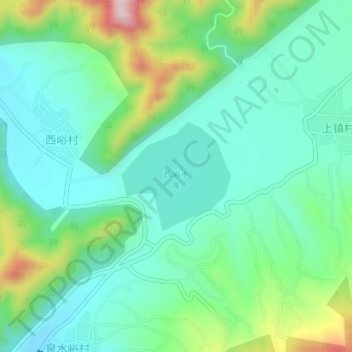
Name: 西峪水库 topographic map, elevation, terrain.
Location: 西峪水库, 西峪村, 平谷区, 北京市, 中国 (40.31096 117.08710 40.31934 117.09809)
Average elevation: 833 ft
Minimum elevation: 564 ft
Maximum elevation: 1,558 ft