
Vogna topographic map
Interactive map
Click on the map to display elevation.
About this map
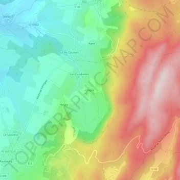
Name: Vogna topographic map, elevation, terrain.
Average elevation: 1,824 ft
Minimum elevation: 1,171 ft
Maximum elevation: 2,707 ft
Other topographic maps
Click on a map to view its topography, its elevation and its terrain.
Chisséria
France > Bourgogne-Franche-Comté > Jura > Arinthod
Chisséria, Arinthod, Lons-le-Saunier, Jura, Bourgogne-Franche-Comté, France métropolitaine, 39240, France
Average elevation: 1,673 ft
Le Sauvieux
France > Bourgogne-Franche-Comté > Jura > Arinthod
Le Sauvieux, Arinthod, Lons-le-Saunier, Jura, Bourgogne-Franche-Comté, France métropolitaine, 39240, France
Average elevation: 1,496 ft