
Piedra Sola topographic map
Interactive map
Click on the map to display elevation.
About this map
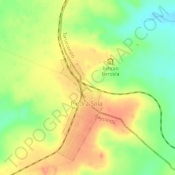
Name: Piedra Sola topographic map, elevation, terrain.
Location: Piedra Sola, Tacuarembó, 45003, Uruguay (-32.08157 -56.31091 -32.07403 -56.30557)
Average elevation: 768 ft
Minimum elevation: 659 ft
Maximum elevation: 863 ft