
Thank you for supporting this site ❤️
Make a donation
Make a donation
Gear up for your next adventure:
As an Amazon Associate, this site earns from qualifying purchases at no extra cost to you.
Ghizzano topographic map
Click on the map to display elevation.
Thank you for supporting this site ❤️
Make a donation
Make a donation
Gear up for your next adventure:
As an Amazon Associate, this site earns from qualifying purchases at no extra cost to you.
About this map
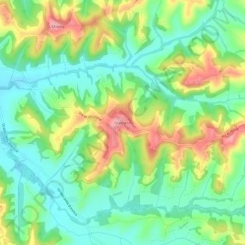
Name: Ghizzano topographic map, elevation, terrain.
Location: Ghizzano, Peccioli, Pisa, Tuscany, 56037, Italy (43.51967 10.77300 43.55967 10.81300)
Average elevation: 338 ft
Minimum elevation: 171 ft
Maximum elevation: 623 ft
Thank you for supporting this site ❤️
Make a donation
Make a donation
Gear up for your next adventure:
As an Amazon Associate, this site earns from qualifying purchases at no extra cost to you.