
Oświęcim topographic map
Interactive map
Click on the map to display elevation.
About this map
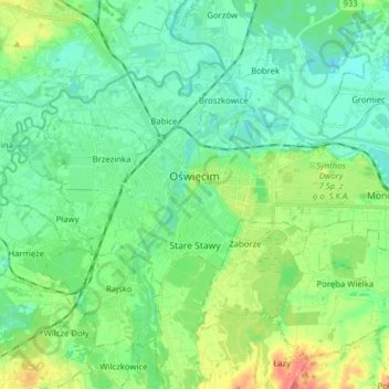
Name: Oświęcim topographic map, elevation, terrain.
Location: Oświęcim, Oświęcim County, Lesser Poland Voivodeship, Poland (50.00957 19.17785 50.05707 19.33445)
Average elevation: 784 ft
Minimum elevation: 728 ft
Maximum elevation: 922 ft