Geolocate

Barangay 4 topographic map

Click on the map to display elevation.

About this map

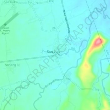
Name: Barangay 4 topographic map, elevation, terrain.

Location: Barangay 4, Aurora, Central Luzon, 3201, Philippines (15.69788 121.49849 15.73788 121.53849)

Average elevation: 98 ft

Minimum elevation: 30 ft

Maximum elevation: 427 ft

Other topographic maps

Click on a map to view its topography, its elevation and its terrain.

Diguisit Beach

Philippines > Aurora > Baler

Average elevation: 131 ft

Casapsapan Beach

Philippines > Aurora > Casiguran

Average elevation: 72 ft

Gear up for your next adventure:

🧭Orienteering Set - Complete compass and map reading kit
🕶️Glacier Sunglasses - Side shields to protect eyes from high-altitude snow glare
🔭Telescopic Hiking Pole - Adjustable pole for hiking stability
🌲Outdoor Survival Books - Best books on survival skills
🧣Hiking Neck Gaiter - Multi‑use neck protection for outdoor weather

As an Amazon Associate, this site earns from qualifying purchases at no extra cost to you.