
Martinskirchen topographic map
Interactive map
Click on the map to display elevation.
About this map
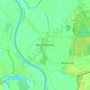
Name: Martinskirchen topographic map, elevation, terrain.
Location: Martinskirchen, Elbe-Elster, Brandenburg, Deutschland (51.45171 13.18379 51.49171 13.22379)
Average elevation: 292 ft
Minimum elevation: 269 ft
Maximum elevation: 315 ft