
Make a donation
Gear up for your next adventure:
As an Amazon Associate, this site earns from qualifying purchases at no extra cost to you.
Kotli topographic map
Click on the map to display elevation.
Make a donation
Gear up for your next adventure:
As an Amazon Associate, this site earns from qualifying purchases at no extra cost to you.
Kotli
Kotli Tungal (Kotli) is a small town in Himachal Pradesh, in northern India located along national highway 70 (updated 003) which connects Jalandhar (in Punjab) to Mandi. It is 22 km (14 mi) from the town of Mandi, Kotli is a Sub Division and Tehsil (Sub District) of Mandi District. Kotli and the surrounding area are also known as Tungal Valley. The center of Tungal Valley is Kotli, where The NH 70 (003) from Mandi to Jalandhar passes through Kotli. Tungal Valley is covered with lush green forests of oak and cedar deodar. Rechara Dev Temple, Mahan Dev Temple, Kali Mata Temple, Janitri mata temple, Nagan mata mandir, Jhumba Ri Jogni Mata Temple are the main temples of the area. Jhumb dhar located at an altitude of 2,100 m (6,900 ft) from sea level is height peak of the area. Pahari and Hindi are spoken.
Make a donation
Gear up for your next adventure:
As an Amazon Associate, this site earns from qualifying purchases at no extra cost to you.
About this map
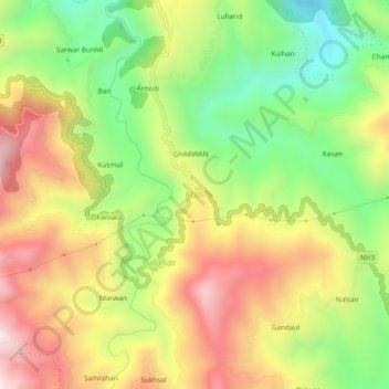
Name: Kotli topographic map, elevation, terrain.
Location: Kotli, Mandi, Himachal Pradesh, 175003, India (31.73691 76.85269 31.77691 76.89269)
Average elevation: 3,917 ft
Minimum elevation: 2,789 ft
Maximum elevation: 5,138 ft
Make a donation
Gear up for your next adventure:
As an Amazon Associate, this site earns from qualifying purchases at no extra cost to you.