
Russa topographic map
Interactive map
Click on the map to display elevation.
About this map
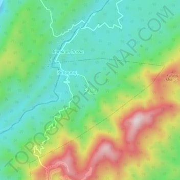
Name: Russa topographic map, elevation, terrain.
Location: Russa, Kanubari ADC, Longding, Arunachal Pradesh, India (27.02444 95.26452 27.06444 95.30452)
Average elevation: 1,056 ft
Minimum elevation: 433 ft
Maximum elevation: 2,182 ft