
Chityala topographic map
Interactive map
Click on the map to display elevation.
About this map
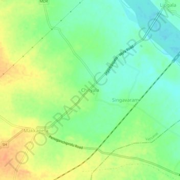
Name: Chityala topographic map, elevation, terrain.
Location: Chityala, Vatsavai, NTR, Andhra Pradesh, 521193, India (16.91499 80.18203 16.95499 80.22203)
Average elevation: 236 ft
Minimum elevation: 180 ft
Maximum elevation: 299 ft
Other topographic maps
Click on a map to view its topography, its elevation and its terrain.
Munneru River
India > Andhra Pradesh > Vatsavai
Munneru River, Vatsavai, NTR District, Andhra Pradesh, India
Average elevation: 308 ft