
Rödlin topographic map
Interactive map
Click on the map to display elevation.
About this map
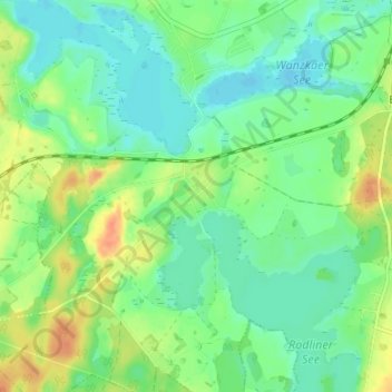
Name: Rödlin topographic map, elevation, terrain.
Average elevation: 223 ft
Minimum elevation: 177 ft
Maximum elevation: 305 ft
Other topographic maps
Click on a map to view its topography, its elevation and its terrain.
Wanzka
Deutschland > Mecklenburg-Vorpommern > Mecklenburgische Seenplatte > Blankensee
Wanzka, Blankensee, Neustrelitz-Land, Mecklenburgische Seenplatte, Mecklenburg-Vorpommern, Deutschland
Average elevation: 226 ft
Rollenhagen
Deutschland > Mecklenburg-Vorpommern > Mecklenburgische Seenplatte > Blankensee
Rollenhagen, Blankensee, Neustrelitz-Land, Mecklenburgische Seenplatte, Mecklenburg-Vorpommern, Deutschland
Average elevation: 253 ft