
Kalender Mahallesi topographic map
Interactive map
Click on the map to display elevation.
About this map
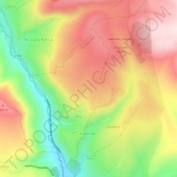
Name: Kalender Mahallesi topographic map, elevation, terrain.
Location: Kalender Mahallesi, Damal, Ardahan, Ostanatolien, Türkei (41.34418 42.82856 41.38286 42.85037)
Average elevation: 7,241 ft
Minimum elevation: 6,516 ft
Maximum elevation: 7,854 ft