
Lac Perreault topographic map
Interactive map
Click on the map to display elevation.
About this map
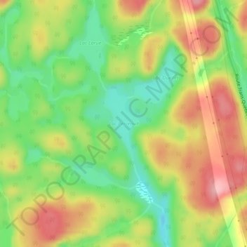
Name: Lac Perreault topographic map, elevation, terrain.
Average elevation: 1,099 ft
Minimum elevation: 889 ft
Maximum elevation: 1,325 ft
Other topographic maps
Click on a map to view its topography, its elevation and its terrain.
Lac Sainte-Anne
Canada > Québec > Manicouagan > Rivière-aux-Outardes
Lac Sainte-Anne, Rivière-aux-Outardes, Manicouagan, Côte-Nord, Québec, Canada
Average elevation: 1,424 ft