
Chenini topographic map
Interactive map
Click on the map to display elevation.
About this map
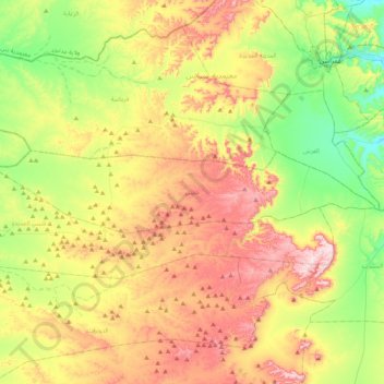
Name: Chenini topographic map, elevation, terrain.
Average elevation: 1,319 ft
Minimum elevation: 725 ft
Maximum elevation: 2,113 ft
Other topographic maps
Click on a map to view its topography, its elevation and its terrain.
Ras El Oued
Tunisie > Gouvernorat Tataouine
Ras El Oued, Délégation Tataouine Sud, Gouvernorat Tataouine, 3264, Tunisie
Average elevation: 1,348 ft
Bir Amir
Tunisie > Gouvernorat Tataouine
Bir Amir, Délégation Remada, Gouvernorat Tataouine, Tunisie
Average elevation: 814 ft