Bois Clair topographic map
Interactive map
Click on the map to display elevation.
About this map
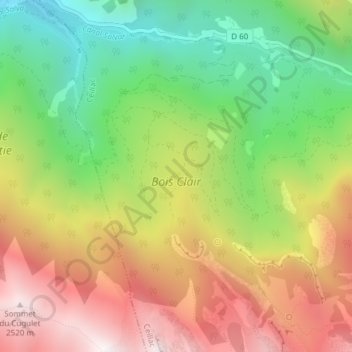
Name: Bois Clair topographic map, elevation, terrain.
Average elevation: 6,043 ft
Minimum elevation: 3,999 ft
Maximum elevation: 8,323 ft

Click on the map to display elevation.
Name: Bois Clair topographic map, elevation, terrain.
Average elevation: 6,043 ft
Minimum elevation: 3,999 ft
Maximum elevation: 8,323 ft