
Rumelifeneri topographic map
Interactive map
Click on the map to display elevation.
About this map
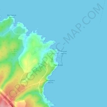
Name: Rumelifeneri topographic map, elevation, terrain.
Location: Rumelifeneri, Sarıyer, Istanbul, Marmara Region, Turkey (41.21340 29.09093 41.25340 29.13093)
Average elevation: 66 ft
Minimum elevation: -3 ft
Maximum elevation: 449 ft