
Thank you for supporting this site ❤️
Make a donation
Make a donation
Gear up for your next adventure:
As an Amazon Associate, this site earns from qualifying purchases at no extra cost to you.
Portunhos topographic map
Click on the map to display elevation.
Thank you for supporting this site ❤️
Make a donation
Make a donation
Gear up for your next adventure:
As an Amazon Associate, this site earns from qualifying purchases at no extra cost to you.
About this map
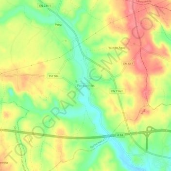
Name: Portunhos topographic map, elevation, terrain.
Location: Portunhos, Cantanhede, Coimbra, 3025-341, Portugal (40.27607 -8.56432 40.31607 -8.52432)
Average elevation: 269 ft
Minimum elevation: 118 ft
Maximum elevation: 410 ft
Thank you for supporting this site ❤️
Make a donation
Make a donation
Gear up for your next adventure:
As an Amazon Associate, this site earns from qualifying purchases at no extra cost to you.