
Champawat topographic map
Interactive map
Click on the map to display elevation.
About this map
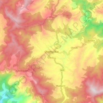
Name: Champawat topographic map, elevation, terrain.
Location: Champawat, Uttarakhand, 262523, India (29.29727 80.05209 29.37727 80.13209)
Average elevation: 5,591 ft
Minimum elevation: 3,465 ft
Maximum elevation: 7,008 ft