
San Buenaventura topographic map
Interactive map
Click on the map to display elevation.
About this map
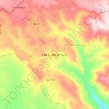
Name: San Buenaventura topographic map, elevation, terrain.
Location: San Buenaventura, Francisco Morazán, Honduras (13.85709 -87.23996 13.93709 -87.15996)
Average elevation: 4,157 ft
Minimum elevation: 2,359 ft
Maximum elevation: 5,495 ft