Geolocate

Zacayuca topographic map

Interactive map

Click on the map to display elevation.

About this map

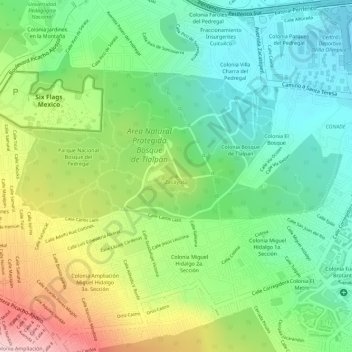
Name: Zacayuca topographic map, elevation, terrain.

Location: Zacayuca, Tlalpan, CDMX, 14266, Mexique (19.28945 -99.19948 19.28955 -99.19938)

Average elevation: 7,881 ft

Minimum elevation: 7,503 ft

Maximum elevation: 8,474 ft

Other topographic maps

Click on a map to view its topography, its elevation and its terrain.

Miguel Hidalgo

Mexique > CDMX

Miguel Hidalgo, CDMX, Mexique

Average elevation: 7,497 ft

Tláhuac

Mexique > CDMX

Tláhuac, CDMX, Mexique

Average elevation: 7,507 ft

Álvaro Obregón

Mexique > CDMX

Álvaro Obregón, CDMX, Mexique

Average elevation: 9,232 ft

Benito Juárez

Mexique > CDMX

Benito Juárez, CDMX, Mexique

Average elevation: 7,375 ft

Venustiano Carranza

Mexique > CDMX

Venustiano Carranza, CDMX, Mexique

Average elevation: 7,316 ft

Gustavo A. Madero

Mexique > CDMX

Gustavo A. Madero, CDMX, Mexique

Average elevation: 7,562 ft