
Thank you for supporting this site ❤️
Make a donation
Make a donation
Gear up for your next adventure:
As an Amazon Associate, this site earns from qualifying purchases at no extra cost to you.
Limbe topographic map
Click on the map to display elevation.
Thank you for supporting this site ❤️
Make a donation
Make a donation
Gear up for your next adventure:
As an Amazon Associate, this site earns from qualifying purchases at no extra cost to you.
About this map
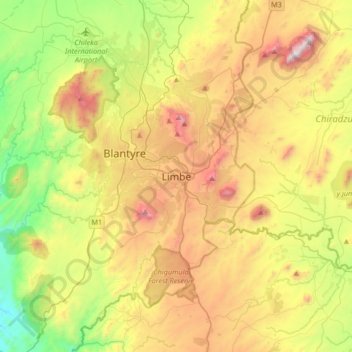
Name: Limbe topographic map, elevation, terrain.
Location: Limbe, Blantyre, Southern Region, Malawi, Malawi (-15.96744 34.89250 -15.64744 35.21250)
Average elevation: 3,074 ft
Minimum elevation: 1,076 ft
Maximum elevation: 5,820 ft
Thank you for supporting this site ❤️
Make a donation
Make a donation
Gear up for your next adventure:
As an Amazon Associate, this site earns from qualifying purchases at no extra cost to you.