
Oberwiesenthal topographic map
Interactive map
Click on the map to display elevation.
About this map
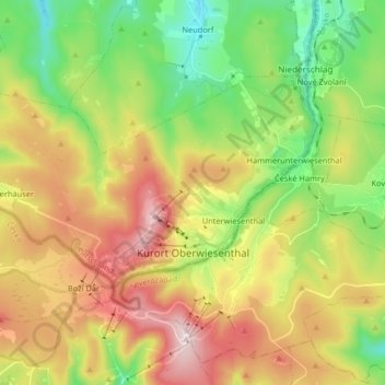
Name: Oberwiesenthal topographic map, elevation, terrain.
Location: Oberwiesenthal, Erzgebirgskreis, Saksen, Duitsland (50.40402 12.85948 50.46706 13.02269)
Average elevation: 3,022 ft
Minimum elevation: 2,221 ft
Maximum elevation: 4,094 ft