
Gibecq topographic map
Interactive map
Click on the map to display elevation.
About this map
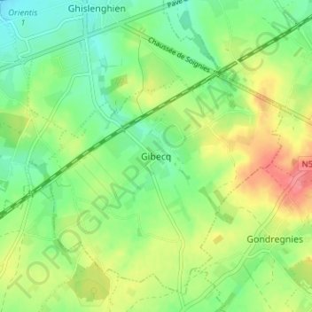
Name: Gibecq topographic map, elevation, terrain.
Location: Gibecq, Ath, Hainaut, Wallonie, 7823, Belgique (50.61767 3.86782 50.65767 3.90782)
Average elevation: 197 ft
Minimum elevation: 105 ft
Maximum elevation: 335 ft