
麻城市 topographic map
Interactive map
Click on the map to display elevation.
About this map
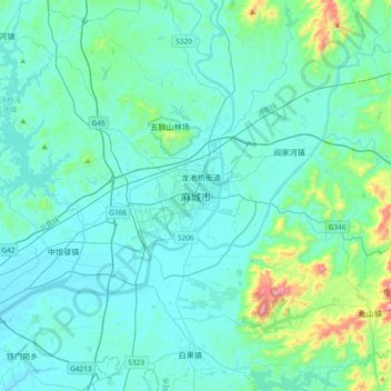
Name: 麻城市 topographic map, elevation, terrain.
Location: 麻城市, 南湖, 麻城市, 湖北省, 中国 (31.01082 114.85592 31.33082 115.17592)
Average elevation: 387 ft
Minimum elevation: 105 ft
Maximum elevation: 2,480 ft